Central Government Public Sector Mapping Agreement (PSMA)
Go to the Ordnance Survey site (opens in a new window)
Public Sector Mapping Agreement
All Ordnance Survey base maps have been provided under the Public Sector Mapping Agreement with the Ordnance Survey and are subject to Ordnance Survey copyright. The base mapping should only be used for the purpose of displaying data sets from the MAGIC information resource.
Ordnance Survey raster datasets available in MAGIC
MAGIC contains five scales of Ordnance Survey raster base mapping – VectorMap Local, 1:25,000, 1:50,000, 1:250,000 and MiniScale® maps, displayed at a range of scales:
| Raster Dataset | Minimum Scale | Maximum Scale | Version Date |
|---|---|---|---|
| MiniScale® | 1:250,051 | 1:2,500,000 | 2018 |
| 1:250,000 | 1:62,501 | 1:250,050 | 2018 |
| 1:50,000 | 1:25,051 | 1:62,500 | 2018 |
| 1:25,000 | 1:10,051 | 1:25,050 | 2018 |
| VectorMap Local | 1:101 | 1:10,050 | 2018 |
Watermarking
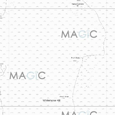
You will notice that every VectorMap Local Ordnance Survey map you view in MAGIC has a watermarked logo in the background. This is an essential requirement to protect the copyright of the Ordnance Survey mapping and of the information contained in MAGIC. You should never try and remove the watermark from any print or screen capture.

Ordnance Survey vector datasets available in MAGIC
The default Map Search in the Interactive map (County, Place or Postcode) uses datasets derived from Boundary-Line™, OS Open Names and OS Code-Point.
| Vector Dataset | Version Date |
|---|---|
| Boundary-Line™ | 2012 |
| OS Open Names | October 2020 |
| OS Code-Point | October 2025 |
Ordnance Survey Website
Further details about these products can be found on the Ordnance Survey website.
Copyright Information
The mapping and dataset download facility on MAGIC has been designed to enable the MAGIC partner organisations to share geographic information about the natural environment.
Ordnance Survey Data
The context mapping used to display information on MAGIC is provided by Ordnance Survey and is Crown copyright material. Crown Copyright also exists in the datasets available for download on MAGIC as they have been derived from Ordnance Survey mapping. Any third parties (i.e. non partner organisations) wishing to use MAGIC mapping outputs or downloaded datasets for commercial / business purposes must be appropriately licensed by Ordnance Survey. For further information on Ordnance Survey licensing go to this website.
Maps and data downloaded or printed from MAGIC
Dataset Download see Dataset Download and Listings page.
Use of Map Image or Printed Map
An individual may use a map image or copy of a printed map created in MAGIC, for their immediate and personal reference only. If you use a map printed or obtained from the MAGIC web site you should use it in that format i.e. with the MAGIC logo, watermarking if appropriate and copyright statement visible.
Further reproduction of the image or hard copy, either for internal or external purposes, whether or not for commercial gain, will require the end user to have a current licence with OS for the required re-use or be issued with a contractor licence if the work is being done under contract for an organisation that has a valid OS licence.
Copyright Statement for maps printed from MAGIC
If you use a printed map the copyright statement is automatically added to the printed map image, however if it is illegible please add the following text 8 point or larger font size:
"Map produced by MAGIC on [date]. © Crown Copyright and database rights [year]. Ordnance Survey 100022861. Copyright resides with the data suppliers and the map must not be reproduced without their permission. Some information in MAGIC is a snapshot of information that is being maintained or continually updated by the originating organisation. Please refer to the documentation for details, as information may be illustrative or representative rather than definitive at this stage".
Terms of Use
Intellectual Property Disclaimer
The MAGIC application contains information which belongs to other parties. Users must ensure that any use of information does not breach the owner's copyright. If it is unclear whether any particular use is permissible a user should contact the copyright owner. The information supplied on MAGIC is updated periodically by the organisations that provide it. Users must check that any information accessed is current and addresses any specific purpose for which they propose to use it. Data supplied to MAGIC will have been captured for a specific purpose, at a scale relevant to this purpose. This does not guarantee that the data is fit for any other purpose.
General Disclaimer
The materials contained on this website are of a general, informational, nature. We have used reasonable endeavours to ensure the accuracy and completeness of the contents of the pages on this site but the information does not constitute advice and must not be relied on as such.
To the fullest extent allowed by law, Defra and the MAGIC partner organisations will not be held responsible for any loss, damage, or inconvenience of any nature whatsoever caused as a result of any inaccuracy or error within these pages. Links to other sites from these pages are for information only and Defra and the MAGIC partner organisations accept no responsibility or liability for access to, or the material on, any site which is linked from or to this site. We periodically review web links to ensure that sites can be accessed. If, however, you have difficulties accessing a site we would like to know. Please contact with full details.
Defra and the MAGIC partner organisations do not endorse or accept responsibility for the material of any website referred to or accessed through this site.